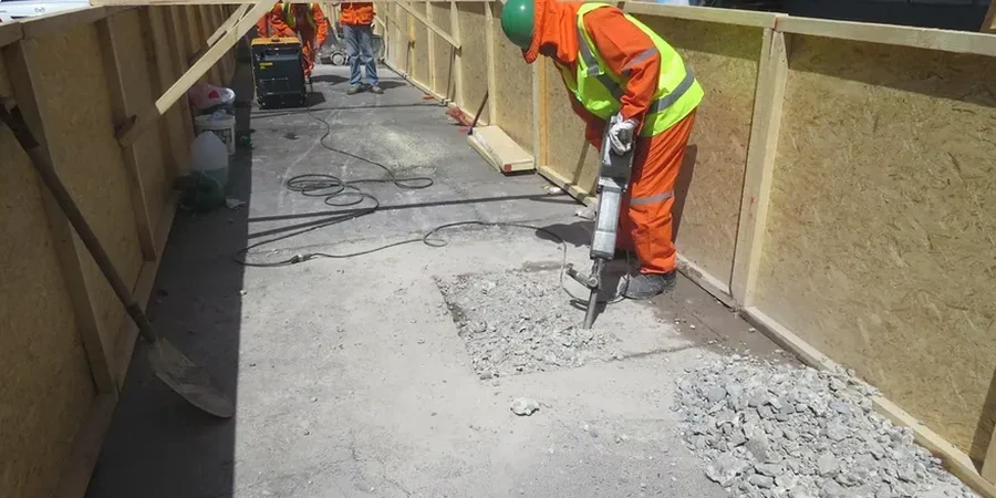
When you're building on the expansive clay formations that run through the Trinity River corridor, surface clues rarely tell the full story. In Irving, we keep seeing projects where the design team assumed uniform stiff clay only to find sand lenses or moisture-sensitive layers three feet down. An exploratory test pit lets you walk the excavation, photograph the strata, and collect undisturbed samples before your foundation contractor commits to a number. Our crew handles the backhoe coordination, OSHA-compliant shoring, and ASTM D2487 logging so you get a defensible geotechnical record that the City of Irving plan reviewer will accept without pushback. For deeper bearing evaluation beyond eight feet, we often pair the pit program with SPT drilling to capture blow counts where trench safety becomes impractical.
An open excavation remains the most direct method to map desiccation cracks, jointing, and perched water that boreholes often miss.